
Compiled by the Settlement Cartography & Survival Committee. Last revised Day 712. If you are reading this guide, you are either planning to stay or trying not to die. Ideally both.
Geography
Heceta Island sits in the Alexander Archipelago of Southeast Alaska, approximately 31 nautical miles west of Craig on Prince of Wales Island. It covers 178 square kilometers (69 square miles) — roughly the size of the city of Spokane, except instead of strip malls and Applebee’s, it’s covered in 800-year-old Sitka spruce. We consider this an upgrade.
The terrain is mountainous, rising to approximately 1,000 meters at its highest point. The coastline is 188 kilometers of rocky shore, protected coves, and a handful of beaches suitable for landing small craft. The interior is dense temperate rainforest — Tongass National Forest, technically, though “national” is doing a lot of heavy lifting these days.
To our north lies Kosciusko Island. To the northeast, Tuxekan Island. South are the Maurelle Islands, and beyond them Noyes Island and Lulu Island. All uninhabited as far as we know, though the Radio Log occasionally picks up something from the Noyes Island direction that might be people or might be whales. We’re honestly not sure.
Climate
Temperate maritime rainforest. Annual rainfall: 80 to 220 inches depending on elevation and which god you’ve recently offended. Average temperature ranges from about 1°C in January to 14°C in July. Snow is possible but rare at sea level. Frost is common November through March.
In practical terms: it rains. It rains a great deal. It rains with a commitment and consistency that you will initially find depressing, then maddening, then oddly comforting once you stop fighting it. Former desert residents should prepare for a significant adjustment period. Former Seattleites will feel right at home and should stop complaining.
The upside: the rain is why everything here is alive. The forest floor is a sponge. The streams run year-round. The salmon come because the streams run. We eat because the salmon come. Thank the rain.
Water
Fresh water is abundant. The island has multiple year-round streams, the largest being Chuck Creek on the eastern shore (near the settlement’s primary camp). Stream water above the tidal influence is drinkable after boiling. We maintain three rain catchment systems at the main shelter complex.
Do not drink from tidal areas. Do not drink from standing pools near the shore. If you are unsure whether water is safe, ask someone. Dysentery is not the adventure you think it is.
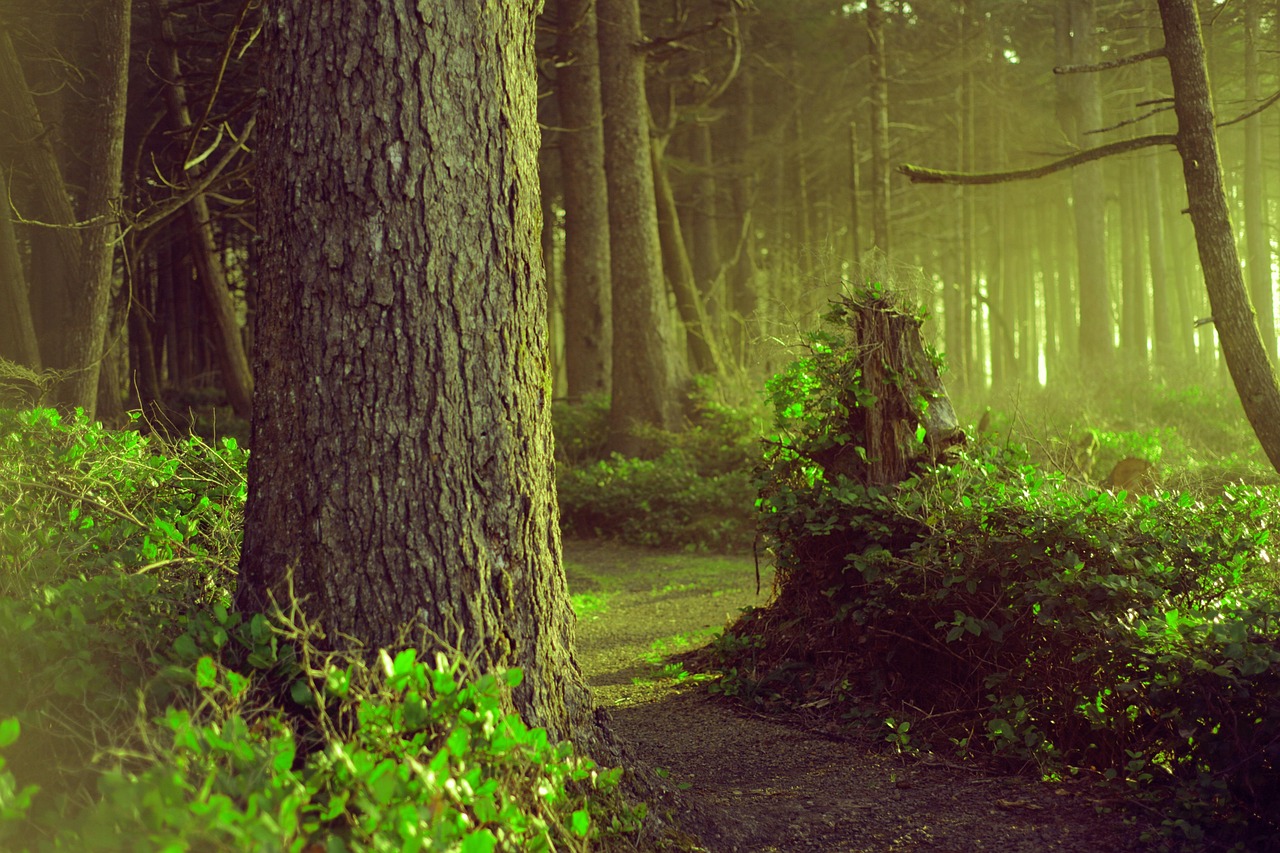
Forests
79% of the island is forested. Primary species: Sitka spruce (Picea sitchensis), western hemlock (Tsuga heterophylla), western red cedar (Thuja plicata), and yellow cedar (Callitropsis nootkatensis). The understory is dense with blueberry, huckleberry, salmonberry, devil’s club (avoid), and ferns.
The old-growth trees here are not decorative. They are infrastructure. They break the wind. Their root systems prevent erosion. Their canopy moderates temperature. Dead falls provide shelter, fuel, and building material. The forest is not scenery — it is the system that keeps us alive. Treat it accordingly.
Wildlife: What Will Feed You
Sitka black-tailed deer — The primary terrestrial game animal. Present year-round. Best hunted in autumn when they move to lower elevations. We maintain a strict harvest quota managed by the Council. Poaching from the communal quota is one of three offenses that will get you removed from the settlement. (The other two involve the fuel reserve and Dale’s boat. Don’t ask about Dale’s boat.)
Salmon — All five Pacific species: king (chinook), sockeye (red), coho (silver), pink (humpy), and chum (dog). Runs begin in late spring and continue through autumn. Salmon is the backbone of our food system. We smoke it, dry it, salt it, and eat it fresh. If you are tired of salmon, keep that opinion to yourself.
Shellfish — Clams, mussels, cockles, and Dungeness crab in the intertidal zones. Harvesting is regulated by tide and season. Paralytic shellfish poisoning is real and can kill you. Follow the posted advisories or accept the consequences.
Marine mammals — Harbor seals, sea otters, and the occasional sea lion in surrounding waters. We do not currently hunt marine mammals. The Tlingit did, expertly, with specialized tools and knowledge we do not possess. Someday, perhaps. For now, we watch them and try to learn.
Wildlife: What Will Feed On You
Brown bears — Present in significant numbers. They are not aggressive unless provoked, surprised, or near their cubs. They are, however, large, fast, and entirely unimpressed by your former job title. Travel in groups. Make noise. Do not run. If you encounter one, back away slowly and speak in a calm voice. If it charges, stand your ground — most charges are bluffs. If it is not a bluff, well, it was nice knowing you.
Wolves — Present but rarely seen. The Alexander Archipelago wolf is a distinct subspecies and tends to avoid humans. If you hear them at night, that is normal. If they sound close, that is also normal. If they sound like they’re inside your shelter, that is not normal and you should alert someone.
Navigation
There are no roads. There are no trails in the conventional sense. There are game paths, creek beds, and routes that experienced members of the settlement have marked with orange flagging tape. Do not remove the flagging tape. Do not leave the marked routes without telling someone where you’re going and when you expect to return.
GPS does not work. Your phone — if you still have one — is a paperweight. Navigation is by compass, landmarks, and the knowledge of people who have walked this island for two years. Listen to them.
“The island doesn’t care about your résumé. It cares about whether you can read a tide chart.”
— Linda Okamoto, Settlement Cartography Committee Chair